After nearly dying and making a valliant attempt at killing the van in Death Valley, we were more than ready to find some cool weather and higher elevation. The only way leading out of Death Valley is NO joke, especially for the poor van that had to climb miles among miles of a 9% graded road. When we finally breached the top, our eyes immediately set out to the vast and magnificent Sierra Nevadas. This came as a very welcomed surprise as we were unaware that we'd come out smack dab at the base of Mt. Whitney.
The Sierra's require permits to access the backcountry so the first order of business was to stop at the permitting office and get all the necessacary paperwork to start our adventure. As we were reading all the important information we stumbled across a situation very unique to this area. Bears EAT cars. What?! Apparently if you have anything that slightly resembles food, has an odor, or even the slightest bit of clutter inside your vehicle bears will tear off doors, smash windows, or rip off the roof. As one might imagine this proposes a small inconvenience for us, travelling with 6 months worth of outdoor gear, food to feed us for a week, and all the toiletries that go along with the time period does not bode well for leaving the turtle at the trailhead. Not only is there food in the van but we cook in the every single night allowing the odors to permeate the soft luxurious carpeted walls and become indeterminately soaked with every smell imaginable. Yep, the turtle is certain to get eaten by bears. The road from the town to the trailhead is 13 miles with 4,000ft of elevation gain. Walking this doesn't seem too appealing so we contact a few shuttle services, both of which want somewhere around $70 EACH way! They must be kidding, I'd rather walk. We mull over how we are going to get ourselves to the trailhead for nearly half a day when we finally decide that we will drive the van partially up the road to a BLM campsite and leave it parked there for 4 days. There is only about 7 more miles that we need to go until we can begin the hike in. Instead of walking up the insanely steep road we start thumbing for rides hoping that some nice soul would be so kind to pick us up. In a short 20 minutes a nice lady who works at the trailhead store picks us up and we are quickly on our way to our destination.

40lb packs, ready to go!
Pick us up please? :)
We have all day to get into camp so we take a slow moderate pace up the 3.5 miles. It's not very far, but its extremely steep mostly off trail including some scrambling with our heavy packs on.
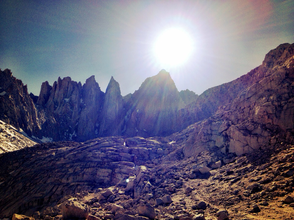
Camp is set at just over 11,000 feet. I think we forgot just how cold it can be at that elevation. As night set in we quickly realized that we have already made 2 mistakes. #1: we brought super light weight summer sleeping bags, the temps were dropping into the low 20's and our bags are rated between 35-40 degrees. It's going to be a chilly evening. #2: we did not bring enough food for the 4 days we planned on being here. Obviously we aren't going to starve, we just mildly underestimated how many calories we'd be burning verses the food we have on hand. So we're gonna be cold and hungry, we'll live. Before crawling into our sleeping bags we took a quick hike to the upper basin so we could get a peak at the glorious Mt. Whitney.

Mt. Whitney is the peak with the sun above it.

view from camp
It may have been the elevation or the cold, maybe both, but neither of us hardley slept a wink. It was a bizzare evening, almost as if our eyes were closed most of the night not actually sleeping but neither awake. When 5AM rolled around we were ready to get up as sleeping wasn't happening and we had a day of altitude conditioning ahead of us. We were going to take a scramble up the east ridge of Mt. Russel to get us acclimated to the high elevation before making an attempt at Whitney. The approach to Russel was a sandy ugly slog until we reached the rocky plateau leading us to the ridge we aimed for.


It's still early season in the high mountains so we ended up running into more snow than originally anticipated. Normally the East Ridge of Russell is more or less an easy scramble. Unfortunately there was a decent amount of snow on the route which forced us into 5th class terrain. I had flimsy clapped out tennis shoes on, no rope or any sort of protection to keep us from falling 2,000 feet to the frozen ground below. To be safe, we chose to give up the thought of summitting and went over to another small peak that was far less forboeding.
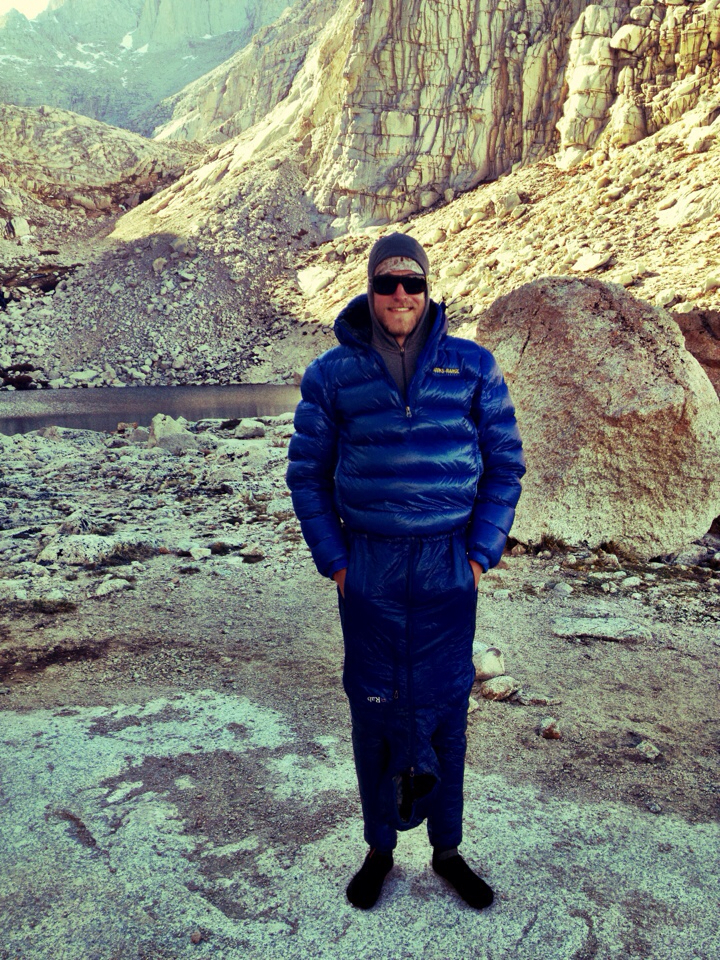
We were feeling fairly acclimatized and ready to make our attempt at summitting Mt. Whitney the next morning, we made some dinner and got bundled up for another sleepless and cold night. Sam got clever and used his synthetic coat as pants to sleep in.
The alarms went off at 4AM and we were both ready to get moving and let the blood start pumping through our systems. Quickly drank some coffee and a peanutbutter roll up, got our packs loaded and we were on the couple hour approach before the sun came up.
Morning glow on Mt. Whitney
After a few hours of hiking to the base of the route, we stopped to rack up, have a goo shot, and change into our ice boots to stomp up the snow field.
The route we chose to do is called the East Buttress that goes at 5.7 for about 12 pitches. We got to the base of the climb around 8:15 and couldn't wait to get started.
There was another party in front of us who had never done an alpine rock route before. the most experience either of them had was top-roping and a little bit of sport climbing. Pretty impressive that this was the first big route they chose to jump on.
The quality of the rock was pretty stellar with impressive exposure under your feet, it made for a great climb to introduce us to the climbing in the high Sierras. Somehow it ended up taking is WAY longer than we had originally anticipated. We finally hit the summit at 5:15 (9 hours of climb time) luckily the sun was still proudly shining and we gladly accepted the warmth it provided.
There was a cool bivy hut on top of the summit!
Getting to the top of any mountian is great but it also signifies that you are only HALF way done. All the excitement of summitting begins to wear away as the realization sinks in that you still have many many hours until back at camp relaxing and reveling in the feat accomplished. We found our way to the decent and began tromping down a snow filled couliour mixed with some rappelling, cramponing, and scrambling we were on our way to camp.
Darkness came too soon and we were still working our way back to camp. Exhausted, hungry, and very very thirsty we rolled into camp at 10:30, making for a very long but worth every second, 20 hour day. We filled up with some calories and H20 before heading to bed for some much needed shut eye.